 Custom Moduling
← Back to selected projectsUrban & master planning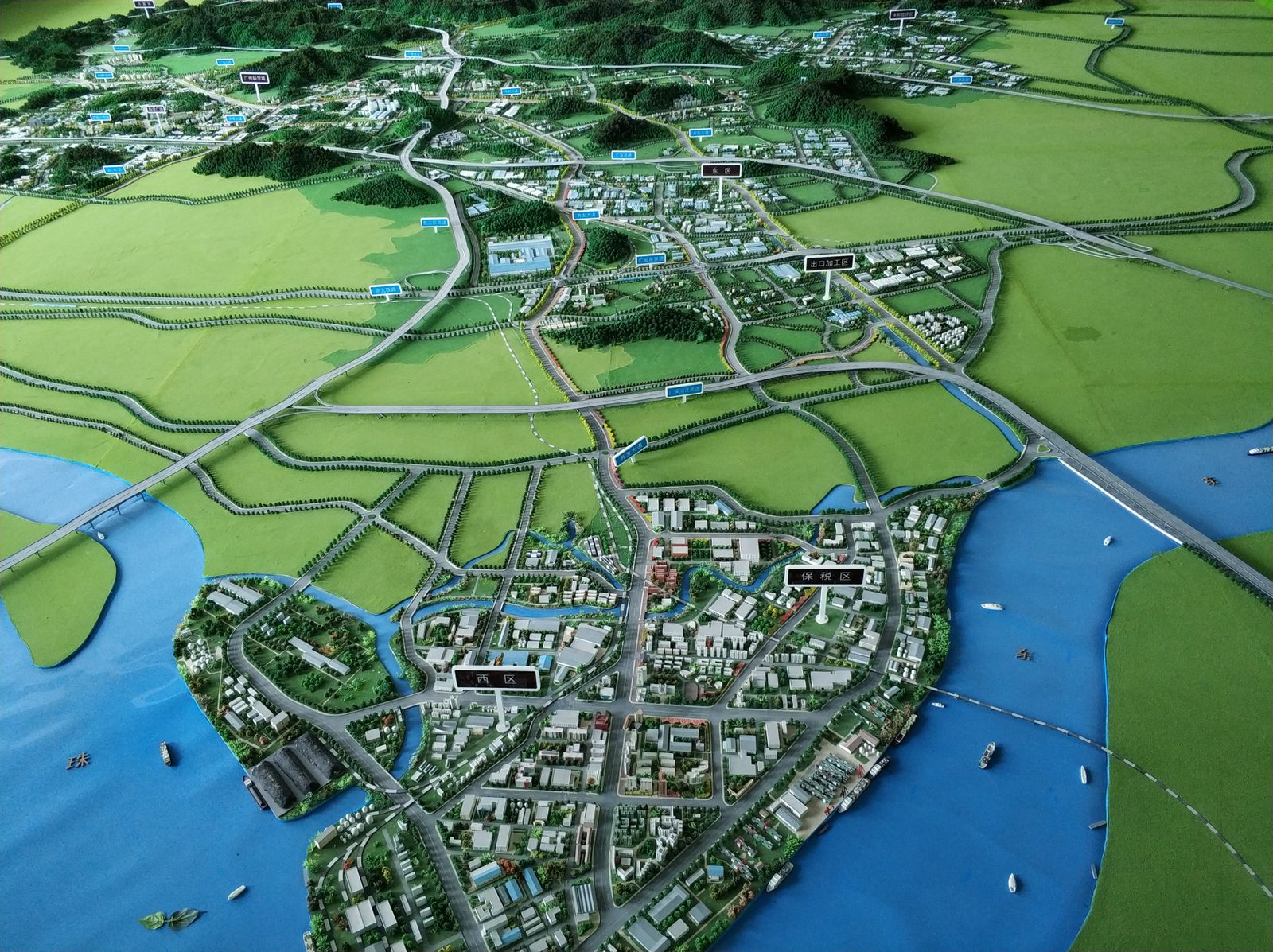
Regional master plan
Delivered · identifiers removed- Purpose
- Explains, at regional scale, the road-network frame, interchange positions, the waterfront and land-use relationships between clusters.
- Model scope
- Regional planning model: urban clusters, scattered villages, hills and woodland, wide farmland, curving expressways with cloverleaf interchanges, river crossings and waterfront, with district tags.
- Key challenge
- Keeping multi-level interchange ramps and overpasses legible — and structurally supported — at regional scale.
- Use
- Planning exhibition hall · planning review · public consultation · investment showcase
Client and project identifiers have been removed. These images show models made in our own factory and are not presented as client references.
Have drawings? Let's see what they can become.
Share your drawings, target size and intended use. We will review the project and outline the next steps.
Get a Free Quote